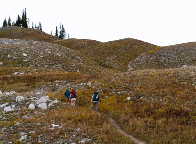

Backcountry navigation looks different in 2026, especially once your phone loses signal or the battery starts slipping. The right handheld can keep you oriented on a ridge, help you retrace a route to camp, or add messaging when a hike runs long. Some picks here are simple trail helpers, while others lean into satellite communication for deeper peace of mind.
The Shortlist At A Glance
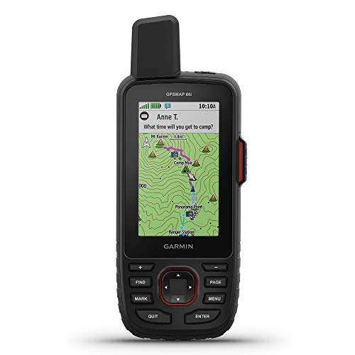
Garmin GPSMAP 66i GPS Handheld and Satellite Communicator

Bushnell BackTrack Mini GPS Navigation

Spot X with Bluetooth 2-Way Satellite Messenger

Garmin eTrex 32x Rugged Handheld GPS Navigator

Garmin eTrex SE GPS Handheld Navigator

SPOT Trace Satellite Tracking Device

Spot Gen 4 Satellite GPS Messenger

Motorola Defy Satellite Link Rugged Handheld GPS Communicator
More Details On Our Top Picks
Backcountry trips get easier to manage when navigation and messaging live in the same handheld, and that’s the lane this Garmin fills. TopoActive mapping means preloaded topo maps built for terrain reading, so you can follow contours, creek crossings, and trail junctions without leaning on your phone.
The inReach side adds satellite communication, which matters most on remote routes where cell service disappears. It suits hikers who carry a pack for long days, travel through unfamiliar trail systems, or want one device to handle wayfinding and check-ins.
Strong Points
- Mapping and messaging live in one unit.
- TopoActive maps help you read terrain at a glance.
- Useful for long routes where phones become a weak backup.
- Good fit for hikers who want fewer devices in their pack.
- Satellite communication adds a useful layer for remote plans.
Things To Consider
- The feature set is deeper than a basic trail GPS, so there is a learning curve.
- Battery planning matters on multi-day routes, especially when you rely on messaging often.
- It can feel like more device than a casual day hiker needs.
Feature Rundown
Who It Suits Best
Hikers, backpackers, and overland travelers who spend real time away from service will get the most from it.
A Better Fit Elsewhere
Bushnell BackTrack Mini GPS Navigation suits you better for short, straightforward outings where retracing your path matters more than messaging.
The BackTrack Mini keeps the idea refreshingly simple, which is useful on casual hikes, hunts, and backpacking trips where you mainly need a clean path back. It records your trip or waypoint and helps guide you toward the starting point, so you spend less time guessing at the trailhead.
That stripped-down approach pairs well with the easy display and glove-friendly buttons, especially in cold weather or while moving quickly. The trade-off is obvious, though, because you are giving up the deeper map and messaging tools found on the Garmin GPSMAP 66i.
What We Like
- Trip and waypoint capture helps you return to your start.
- Glove-friendly controls make it easier to use in cold conditions.
- Display is easy to read on the move.
- Bluetooth sync gives you a cleaner way to store or review routes.
- Waterproof build suits rougher outdoor use.
Room For Improvement
- The screen and control set are simpler than map-heavy handhelds.
- It is better for route retracing than detailed navigation planning.
- Battery management still matters on longer outings.
Feature Snapshot
Built With In Mind
Day hikers and backpackers who want a compact backtrack tool will get along with it quickly.
Another Choice May Suit
Garmin eTrex SE GPS Handheld Navigator is a better fit for hikers who want longer battery focus and a more traditional handheld layout.
This Spot model is built around two-way satellite messaging, so it fits hikers who need more than a one-way ping in the middle of a trip. Bluetooth pairing keeps it tied into your phone workflow, which feels natural for trips where you want text-style communication without giving up satellite reach.
It stands apart from the Garmin GPSMAP 66i by leaning harder into messenger behavior than map-first navigation. The honest read is that it suits planned trips, group travel, and remote routes where sending and receiving notes matters as much as knowing where you are.
Highlights
- Two-way messaging supports back-and-forth communication.
- Bluetooth pairing makes setup and use more familiar.
- Useful for remote travel where phones lose value fast.
- SOS capability adds an important emergency layer.
- Good match for hikers who want messaging first.
Points To Note
- Subscription service is part of ownership.
- It is less about full-map navigation than a dedicated GPS handheld.
- Battery use depends on how often you send messages.
Core Details
Right Fit For
Remote trekkers, camping groups, and anyone who wants satellite texting in a single handheld will find the best match here.
Skip It When
Garmin eTrex 32x Rugged Handheld GPS Navigator is the cleaner choice for hikers who only need straightforward on-trail navigation.
Some hikers want a sturdy handheld that stays out of the way, and the eTrex 32x lands squarely there. It is the kind of unit that makes sense for wayfinding on familiar trails, map checks during travel, and pocket carry on trips where compact size matters more than extra bells and whistles.
Compared with the backtracking-focused Bushnell, this Garmin reads more like a general-purpose navigation tool. That makes it a comfortable step for hikers who want a rugged shell without moving all the way up to satellite communication.
Best Bits
- Rugged build suits rough pack carry.
- Small form factor helps it disappear into a pocket.
- Good middle ground for hikers who want more than a basic backtrack tool.
- Handheld layout feels straightforward for everyday trail use.
Softer Spots
- It does not bring the messaging depth of satellite communicator models.
- Hikers wanting broader phone-style connectivity may want a newer option.
- The plain layout is practical, but not especially fancy.
Details At A Glance
Whose Shelf It Belongs On
Hikers who want a simple rugged GPS without extra communication layers will appreciate the balance here.
Reach For A Different Pick When
Garmin eTrex SE GPS Handheld Navigator is a better match for multi-day use where battery endurance matters more than legacy-style simplicity.
Battery endurance is the headline here, and that changes how you think about a weekend route or a multi-day trek. The eTrex SE also brings Multi-GNSS support, which means it can work with several satellite navigation systems instead of leaning on one, a useful detail in uneven terrain or tree cover.
Bluetooth pairing with Garmin Explore gives you a more connected setup than older-style handhelds, while the 2.2-inch display keeps the footprint compact. It feels well judged for hikers who want modern features without stepping all the way into the more complex Garmin GPSMAP 66i.
Reasons To Buy
- Up to 168 hours of battery life supports long trips.
- Multi-GNSS support broadens satellite access.
- Bluetooth pairing helps with route planning and syncing.
- IPX7 water resistance suits wet trail conditions.
- Small 2.2-inch display keeps the body compact.
Worth Noting
- The smaller screen asks for more careful map reading.
- Bluetooth and app pairing are useful, but not as full-featured as a communicator model.
- Hikers who want larger on-device maps may feel limited by the size.
Feature Card
The Right Fit
Backpackers and hikers who value long battery life above all else will feel right at home with it.
Where A Sibling Pick Shines
Garmin GPSMAP 66i is better for you if satellite messaging and richer map support matter more than battery-first simplicity.
Trail users who mainly care about tracking rather than rich navigation will understand the appeal here fast. SPOT Trace is more about following movement and keeping tabs on a route than about acting like a full map computer, which gives it a very specific job.
That narrow focus helps in situations like monitoring a vehicle, pack, or equipment on longer outdoor trips, and the subscription-based setup suits people who want an always-on tracking layer. It sits apart from the Spot Gen 4 because the emphasis is tracking, not messenger-style back-and-forth.
Positives
- Tracking focus keeps the interface straightforward.
- Good for keeping tabs on equipment or travel routes.
- Useful on outdoor trips where you want a lighter-duty device role.
- Can fit hikers who care more about location history than active navigation.
Small Caveats
- Subscription ownership is part of the picture.
- It is not a full-featured hiking GPS for route planning.
- Best used for tracking rather than detailed on-trail guidance.
Quick Facts
Made For
Hikers and outdoors people who want simple tracking rather than map-heavy navigation will get the cleanest fit.
Look Elsewhere When
Spot X with Bluetooth 2-Way Satellite Messenger is the stronger choice for anyone who wants direct communication along with tracking.
The Gen 4 keeps the message-first approach, but it feels a touch more direct for hikers who want a portable satellite messenger without extra complexity. That makes it a sensible match for camping trips, long trail days, and other outings where sending location-based messages matters more than on-device map depth.
Compared with the Spot X, it leans into a simpler portable messenger role rather than a Bluetooth-tied communication hub. You may find that helpful on trips where you want fewer moving parts and a smaller decision tree.
Positives
- Portable form keeps the device easy to pack.
- Satellite messaging helps on trails away from service.
- Good for users who want communication without a full GPS computer.
- Fits camping and hiking travel nicely.
Areas To Watch
- Subscription-based use adds an ongoing ownership layer.
- It does not replace a full mapping handheld.
- Message-focused design may feel narrow for route-heavy hikers.
Spec Overview
Who Should Grab It
Backpackers and campers who want straightforward satellite messaging in a compact unit are the best match.
A Better Fit Elsewhere
Motorola Defy Satellite Link is the stronger option for hikers who want messenger features tied to a smartphone workflow.
This Motorola option is the most phone-connected pick in the group, which makes sense for hikers who already live in text threads and app alerts. The Defy Satellite Link handles two-way global SMS and SOS alerting, so it works as a rugged satellite companion rather than a standalone full map unit.
Android and iOS compatibility widen the fit, especially for hikers who prefer to keep navigation and messaging in their phone ecosystem. The trade-off is clear, though, because this is more about communication support than trail mapping in the Garmin sense.
Best Bits
- Two-way SMS support feels familiar for everyday texting habits.
- Emergency SOS alerting adds an important off-grid layer.
- Works with both Android and iOS setups.
- Rugged format suits pack carry and rough weather use.
- Good bridge between smartphone comfort and satellite reach.
Honest Caveats
- It is a communicator first, not a dedicated mapping GPS.
- Smartphone pairing means you are still leaning on another device for some tasks.
- Hikers who want everything in one screen may prefer a self-contained handheld.
Core Details
Perfect Match For
Hikers who want satellite messaging tied closely to a smartphone and do not need a map-heavy handheld will feel at home here.
Swap It Out When
Garmin GPSMAP 66i is the better route for you if you want integrated terrain mapping alongside satellite communication.
How To Choose The Right Gps Devices For Hiking
Map Depth Versus Simplicity
Your first decision is how much navigation detail you actually want on the trail. A unit like the Garmin GPSMAP 66i gives you topographic mapping, which helps with ridgelines, drainage lines, and route checks in unfamiliar terrain.
By contrast, the Bushnell BackTrack Mini keeps things lean and direct. That style works well for hikers who mainly want to return to a start point without managing a large map interface.
Battery Life And Trip Length
Battery claims matter more than flashy extras for multi-day use. The Garmin eTrex SE stands out here because its 168-hour figure changes how you think about resupply, while the Bushnell BackTrack Mini’s 35-hour figure fits shorter outings more comfortably.
Long weekends, winter hikes, and shoulder-season trips can stretch a device harder than a sunny afternoon walk. A smaller screen or a simpler interface can help with power use, but communication features usually ask for more careful charging habits.
Communication Needs In The Backcountry
Some hikers need location tracking, while others need real communication beyond cell range. Spot X, Spot Gen 4, and Motorola Defy Satellite Link all address that space, but they do it in different ways, from two-way satellite messaging to phone-linked texting.
That distinction matters on group trips, solo backcountry plans, and remote camping where someone else needs updates. A communicator can feel like a lifesaver in convenience terms, but it also adds subscriptions and a bit more setup.
Durability, Size, And Everyday Carry
Rugged housings and water resistance matter when a device rides outside a pack or gets handled with gloves. The Garmin eTrex 32x and eTrex SE are easier to carry all day than bulkier communicators, while the Bushnell BackTrack Mini keeps pocket load light.
Think about the way you hike, not just the trail itself. A compact handheld suits day hikers and fast packers, while a bigger communicator fits the person who wants a more complete tool on longer, rougher trips.
Things Worth Knowing First
Common Shopping Slip Ups
One common mistake is paying for map depth or messaging when you only need basic route retracing. Another is assuming a phone-linked gadget can replace a dedicated handheld on rough terrain, where battery drain and glare still matter.
It also helps to look past the headline feature and check the ownership side. Subscription-based models bring ongoing usage considerations, while rugged handhelds need enough screen clarity and button size to feel manageable with gloves.
Where The Extra Money Goes
Higher-tier units usually spend more on satellite communication, better navigation support, stronger app pairing, and tougher housings. That is why the Garmin GPSMAP 66i and Spot X sit above simpler trail devices, they are built to handle more jobs at once.
Paying up makes more sense for remote travel, frequent backpacking, or long trips where communication matters as much as route finding. For casual day hikes, that extra capability can sit unused for most outings.
Final Thoughts
Your best match depends on how far you go, how long you stay out, and whether communication matters as much as navigation. The Garmin GPSMAP 66i and Garmin eTrex SE speak to hikers who want stronger trail support, while the Bushnell BackTrack Mini keeps things lighter for simple outings. For more remote travel, the Spot and Motorola picks add satellite communication in different forms. Choose the tool that fits your trail habits, and the rest tends to fall into place.