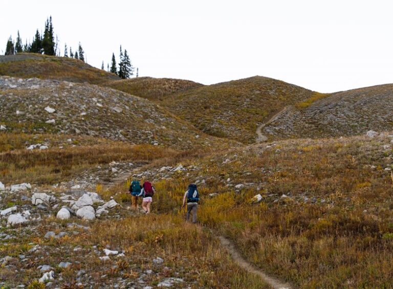

GPS hiking devices matter most when a trail gets quiet, a map fold starts to blur, or your phone battery begins to sink. This roundup focuses on handheld units and satellite messengers that fit different kinds of outings, from day hikes and backcountry trips to longer travel where location sharing matters. You’ll see which models feel simple, which ones bring richer mapping, and which choices make sense for people who want a compact tool they can trust in rough weather or spotty signal areas.
Quick Look At The Shortlist
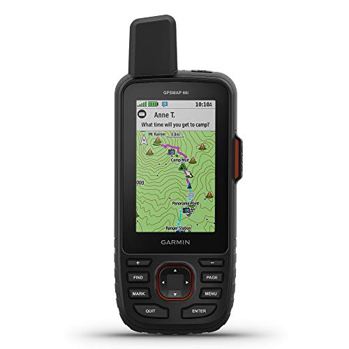
Garmin GPSMAP 66i GPS Handheld and Satellite Communicator

Garmin GPSMAP 67i Rugged GPS Handheld

Spot X with Bluetooth 2-Way Satellite Messenger

Garmin eTrex 32x Rugged Handheld GPS Navigator

Garmin eTrex SE GPS Handheld Navigator

SPOT Trace Satellite Tracking Device

Spot Gen 4 Satellite GPS Messenger

Motorola Defy Satellite Link
More Details On Our Top Picks
The 66i sits in the middle of navigation and communication, which matters on remote routes where your map and your message both need to work. TopoActive mapping gives you trail-aware detail, while inReach support adds satellite messaging for trip updates and check-ins. For hikers who split time between established trails and deeper backcountry, that combination feels well judged.
It does ask for more commitment than a plain handheld GPS, and that trade-off makes sense for you only when location sharing really matters. Compared with the lighter Garmin eTrex models later in this list, this one is built for a more layered trip plan and a more capable screen-first experience.
Strong Points
- Combines handheld navigation with satellite communication in one unit.
- TopoActive mapping supports more confident route reading on the move.
- Useful for long outings where contact with home matters.
- Brings a more complete toolset than simpler eTrex options.
Points To Note
- More feature depth means a steeper setup curve than basic models.
- Satellite features make the plan more involved over time.
- Bulkier than the smallest handhelds, so pocket carry feels less natural.
Feature Snapshot
Who It Suits Best
Backcountry hikers and trip leaders who want navigation plus satellite messaging in one handheld will get the most from it.
A Better Fit Elsewhere
Garmin eTrex SE makes more sense for casual trail use, especially for hikers who want a lighter, simpler handheld without the broader communication setup.
A larger 3-inch sunlight-readable color display gives the 67i a calmer feel for route checks in bright conditions, and that matters more than it sounds like on open ridgelines. Multi-band GNSS means it can work with several satellite navigation signals, while the built-in sensors add context for more demanding trips. Compared with the 66i, this version leans harder into screen clarity and navigation depth.
The renewed listing may suit you best when you want Garmin’s higher-end feature set without starting from scratch on a fresh retail unit. The honest read is that it’s a serious handheld for serious walking, so it fits best in packs that already carry enough water, layers, and patience for longer days.
What We Like
- Large 3-inch screen is easier to read outdoors.
- Two-way messaging and location tracking help during longer trips.
- Interactive SOS support adds a clear emergency communication path.
- Preloaded TopoActive mapping reduces early setup work.
- Multi-band GNSS can improve navigation confidence in tricky terrain.
Room For Improvement
- Renewed condition may matter to shoppers who prefer fresh packaging.
- Satellite features still require an active plan.
- More advanced than a basic handheld, so it asks for more learning time.
Technical Sheet
Built With In Mind
Experienced hikers who want a bright display, richer mapping, and communication support in one rugged unit will feel right at home with it.
Another Choice May Suit
Garmin GPSMAP 66i is the easier leap for hikers who want a very similar Garmin path but prefer the earlier model’s broader fit and often simpler value story.
The Spot X leans into communication first, with Bluetooth pairing that makes message handling feel more connected to your phone. For hikers who want to stay reachable on multi-day routes or coordinate a meeting point after dark, that shape can be more useful than a full mapping device. It’s a straightforward fit for people who know the trail but still want a line back home.
Compared with the Garmin units above, this one is less about rich on-device maps and more about sending and receiving information in the field. The trade-off is clear, and for many camping trips that’s exactly the balance you want.
Reasons To Buy
- Two-way satellite messaging supports real back-and-forth contact.
- Bluetooth pairing makes it easier to manage messages through a phone.
- Useful for hikers, campers, and road trips alike.
- SOS support adds a direct emergency communication layer.
Softer Spots
- Mapping depth is not the focus here.
- Subscription planning matters, so total ownership cost takes more thought.
- Best results come from keeping the device charged and paired before you head out.
Feature Rundown
Whose Shelf It Belongs On
Hikers and campers who care more about staying in touch than studying detailed maps will get the best match from it.
Look Elsewhere When
Garmin GPSMAP 67i is the stronger fit for hikers who want a brighter display and deeper navigation support in the same carry.
The eTrex 32x keeps the shape many hikers want from a handheld, compact, rugged, and plain-spoken. That kind of build makes sense on local trails, where you’d rather glance at directions than spend time digging through menus. In contrast to the more communication-heavy Garmin GPSMAP units, this one feels like a simpler tool that stays out of the way.
For day hikes, map backups, or basic waypoint work, that simplicity is a strength, not a compromise. The honest read is that it suits you best when navigation matters more than messaging, and when you’d rather carry a tool than a whole system.
Highlights
- Rugged build suits regular trail carry.
- Compact size is easy to stash in a pocket or hip belt.
- Good fit for hikers who want a focused GPS tool.
- Less complex than messenger-first units, so day use feels calmer.
Small Caveats
- Does not bring the satellite messaging depth of the GPSMAP line.
- Small-screen handhelds reward careful menu familiarity.
- Owners usually do well keeping the screen and buttons clean after dusty trips.
Core Details
Right Fit For
Trail walkers and casual hikers who want a durable handheld with a simple learning curve will appreciate it most.
Where A Sibling Pick Shines
Garmin eTrex SE suits you better when longer battery expectations and Bluetooth pairing matter more than the older 32x approach.
The eTrex SE looks like the sensible middle ground in this list, especially for hikers who want long battery life without extra communication complexity. Up to 168 hours of use gives you a lot of breathing room on weekend trips, and the 2.2-inch display keeps the unit compact. Compared with the eTrex 32x, this one adds a more modern connection story through Bluetooth and Garmin Explore pairing.
IPX7 water resistance means it’s built to handle brief exposure to water, which is handy on damp trails or sloppy pack days. The trade-off is the small screen, so this feels best in hands that are comfortable with compact devices and simple route checks.
Upsides
- Long battery range supports extended outings.
- Bluetooth pairing with Garmin Explore adds planning flexibility.
- Multi-GNSS support broadens satellite compatibility.
- IPX7 water resistance suits wet weather use.
Areas To Watch
- 2.2-inch screen keeps information compact rather than spacious.
- Small controls can feel cramped with gloves on.
- Keeping the port and buttons free of grit helps maintain smooth use.
At A Glance
Who Should Grab It
Weekend hikers and travel-minded trail users who want a compact GPS with long battery breathing room will feel at home here.
Swap It Out When
Garmin GPSMAP 66i is the stronger pick for you when satellite messaging and richer trail detail matter more than compactness.
Trace is more about keeping tabs than steering every step, and that makes it useful in a different way from the Garmin handhelds above. For hikers, campers, or anyone tracking a car, pack, or piece of gear, that narrower focus can be exactly right. It’s the kind of tool you tuck into the background and let do one job well.
That also means you’re not shopping for a full navigation screen here, so it’s not a match for trail mapping needs. The honest read is that it works best as a quiet tracker, not a hiking command center.
Bright Spots
- Good fit for tracking items or trips over distance.
- Smaller footprint is easier to place on gear.
- Useful beyond hiking, including cars and outdoor equipment.
Things To Consider
- Does not replace a handheld map-and-route GPS.
- Subscription planning matters for long-term use.
- Owners usually benefit from mounting it securely and checking the battery path before each outing.
Details At A Glance
Perfect Match For
Hikers and gear owners who want simple location tracking without a full navigation toolkit will get the most from it.
Reach For A Different Pick When
Garmin eTrex SE is the better fit for hikers who need actual route guidance instead of a background tracker.
Gen 4 keeps the focus on satellite messaging in a slim, portable shape, which is handy for hikers who don’t need a larger map-driven handheld. It suits shorter backcountry plans, camping weekends, and travel where a basic line of contact matters more than deep navigation layers. Compared with the Spot X, this one feels a touch more stripped back and easier to treat as a grab-and-go unit.
That stripped-back feel is the strength, though it also means you should expect less breadth than the Garmin GPSMAP models. For most lightweight carry setups, that trade-off lands in a sensible place.
Best Bits
- Portable shape is easy to pack.
- Satellite messenger role suits contact-first trail use.
- Works well for camping and outdoor travel.
Worth Noting
- Not built around full navigation mapping.
- Subscription planning still shapes the ownership experience.
- Keeping it stowed in a dry pocket helps the unit stay ready for repeat use.
Quick Facts
Best Suited To
Light packers and weekend travelers who want a compact way to send messages from the trail will appreciate it most.
Not Your Match When
Garmin GPSMAP 67i makes more sense for hikers who want a bigger screen and richer on-device navigation tools.
The Defy Satellite Link is the most phone-centered option here, which changes the way you think about satellite communication. Instead of carrying a full standalone navigator, you link it with Android or iOS and use it as a rugged texting and SOS companion. For hikers who already live on their phone and want a lighter satellite add-on, that arrangement can feel more natural than a dedicated handheld.
The trade-off is obvious, since it relies on the phone-side experience more than the Garmin GPSMAP units or Spot handhelds. That makes it a strong fit for mixed-use travel and a weaker fit for someone who wants a single self-contained trail device.
Positives
- Works with both Android and iOS phones.
- Two-way global SMS support fits practical trip check-ins.
- Rugged design suits pack or pocket carry.
- Emergency SOS support adds a useful backstop for remote travel.
Honest Caveats
- Less compelling for hikers who want a full built-in mapping device.
- Phone reliance means you carry and manage two connected devices.
- Best kept updated and charged together with your phone before departure.
Feature Card
The Right Fit
Phone-first hikers and travelers who want satellite messaging without carrying a full handheld GPS will find the setup appealing.
Consider Something Else When
Garmin GPSMAP 66i is the better match for you when you want detailed trail guidance built into the device itself.
How To Choose The Right Gps Hiking Devices
Start With The Kind Of Trail You Walk
Short local hikes reward simple handhelds, while longer backcountry routes call for more detailed mapping and stronger communication tools. A basic navigator like the Garmin eTrex 32x works well for route checks and waypoint use, but a GPSMAP unit gives you more context when the trail gets remote. The right match starts with your usual terrain, not the most feature-packed screen.
Carrying a device that matches your route keeps the pack lighter and the menus easier to learn. That matters on damp mornings, fast breaks, or steep sections where you want one glance and a clear answer. The less time you spend hunting through options, the more time you spend walking.
Decide How Much Communication You Actually Need
Some hikers only need navigation, while others want two-way messaging, location sharing, or an SOS channel. Spot X, Spot Gen 4, and Motorola Defy Satellite Link focus on contact more than cartography, which makes them useful for check-ins and coordinated plans. Garmin GPSMAP models blend maps with communication, so they suit hikers who want a single handheld to do both jobs.
Think about how often you travel beyond cell coverage. A communication-focused device can feel like a spare set of hands on long trips, but it also adds setup steps and usually some ongoing service planning. That trade-off is worth it for remote travel, and less appealing for everyday neighborhood hikes.
Pay Attention To Screen Size, Battery Life, And Grip
A 3-inch display like the one on the Garmin GPSMAP 67i makes reading easier in bright light, while a smaller 2.2-inch screen such as the Garmin eTrex SE keeps the unit more compact. Battery life matters in the same practical way, especially for multi-day hikes where charging access is uncertain. Compact devices are easy to carry, but they also ask for more careful menu work.
Grip, button feel, and water resistance shape daily use more than many specs sheets suggest. IPX7 protection on the eTrex SE helps with wet weather, and rugged shells on the Garmin and Spot units help them handle rough pack life. For most hikers, a device that feels easy in one hand ends up getting used more often than a flashier one.
Match The Device To Your Setup Habits
Phone-linked options, such as the Motorola Defy Satellite Link, make sense for people who already plan trips on a mobile device and want satellite messaging as an add-on. Standalone units suit hikers who prefer a single gadget with fewer moving parts. That choice matters on trail days when dead batteries and scattered gear can turn small inconveniences into bigger ones.
Also think about how you store and carry the unit. A compact handheld slides into a hip belt pocket more easily, while a larger communicator may live better in a chest pocket or pack lid. The best device is the one you can reach quickly and use without second-guessing the controls.
What To Weigh Before You Decide
Mistakes Worth Dodging
Many shoppers focus on satellite features and forget the screen, battery, or button layout. A messenger-only device can look appealing, then feel limited on trail if you expected built-in navigation. You’ll save trouble by matching the product to your actual trip style, not the idea of a perfect all-rounder.
Another common miss is overlooking the service side of satellite tools. A device can be excellent on paper, yet still ask for extra setup or ongoing planning that changes the total ownership picture. That’s why the simplest-looking choice can sometimes be the most practical.
The Upgrade Payoff
Higher-tier models usually cost more because of larger displays, richer mapping, satellite communication, and more advanced positioning support. Those extras matter most on longer routes, remote terrain, or trips where one device must cover several jobs. For weekend strolls on familiar ground, the extra spend can feel unnecessary.
Once you start crossing rougher trails or taking multi-day trips, the added clarity and flexibility begin to earn their keep. The Garmin GPSMAP line shows that pattern clearly, since it gives you deeper navigation support than the simpler eTrex options. Paying up makes sense when the trail, not the budget, should set the pace.
Final Thoughts
The best choice here depends on how much of the trail you want your device to cover. Garmin GPSMAP models give you the richest blend of maps and messaging, while the eTrex line keeps things smaller and easier to live with. Spot devices suit communication-focused travel, and the Motorola option works best for phone-centered use. Pick the tool that fits your hiking rhythm, and you’ll carry it with more confidence.