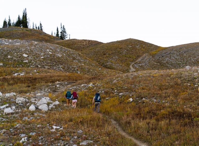
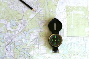

A map keeps outdoor travel clear and reduces mistakes. Learn how symbols, contour lines, and landmarks work together. Use a compass and grid checks to confirm position and direction. Match the paper map to visible terrain to follow routes confidently. These basic skills make outdoor navigation straightforward and safer.
Map Reading Basics for Hikers
A trail map can feel a little intimidating at initially, but once you learn the basics, it becomes a quiet kind of confidence in your hands. You don’t need to know everything at once.
Start with route planning, so you can match your time, energy, and trail goals. Then practice scale interpretation, because it tells you how far you’ll really walk, not just what looks close on paper.
As you check the map, keep your eyes on where you’re and where you want to go next. That simple habit helps you stay calm whenever trails split or twist.
Should you feel unsure, that’s normal. Every hiker starts there. With a little practice, you’ll read the map like a trusted partner, and the trail will feel more welcoming, not less.
Read Topographic Map Symbols
Topographic map symbols help you spot significant details fast, from common signs for roads, water, and camps to special marks that show hills, cliffs, and boundaries.
Whenever you learn these symbols, you can match the map to the land around you and feel more confident on the trail.
Start by noticing trail and landmark symbols, since they guide you to the places you need most.
Common Map Symbols
As soon as you look at a topographic map, the tiny symbols can feel like a secret code initially, but they’re easier to read than you might suppose. You’ll usually see the legend initially, and that’s your key to the whole map. The legend evolution shows how map makers have refined signs over time, while cultural variations can change how a symbol looks from one region to another.
You could spot blue for water, black for man-made features, and green for thicker plant cover. Small squares, circles, and lines help you notice buildings, wells, and roads. Once you learn these common marks, you stop guessing and start moving with confidence. That feels good, because you’re not reading alone anymore; you’re joining a shared outdoor language.
Trail And Landmark Symbols
Trail and landmark symbols can turn a confusing map into a clear path you can trust. Whenever you spot trail markers, you can match them to the route you’re walking and stay with your group more easily.
Next, look for waypoint symbols, since they show key stops like camps, water, or junctions. These signs help you feel calm whenever the woods look the same in every direction.
You don’t need to guess. Instead, read the symbol key, then compare it with the path ahead. Should a river, summit, or shelter appear on the map, you’ll know what it means before you get there.
That simple skill helps you move with confidence, and it keeps your outing feeling shared, safe, and a little more fun.
Figure Out Where You Are
Initially, match the landmarks you see on the ground with the ones on your map so you can tell you’re in the right area.
Then read the grid lines to narrow your spot, since those lines help you track your location with more confidence.
As soon as you use both clues together, you can pinpoint where you’re without feeling lost for long.
Match Landmarks
Landmarks are your map’s way of saying, “You’re close.” Whenever you compare what you see around you with what appears on the map, you can figure out where you are much faster and with a lot less guesswork. Look for a bright river bend, a tall peak, or a split trail that matches the symbols. Even historic cairns can help whenever they stand out on rocky paths. In towns, urban wayfinding works the same way, only with corners, bridges, and public art.
| Landmark | On Map | What It Tells You |
|---|---|---|
| River bend | Blue curve | You’re near water |
| Trail junction | X symbol | You need a choice |
| Stone pile | Cairn icon | You’re on track |
Whenever you spot two or three matches, trust your position and keep moving with confidence.
Read Grid Lines
Grid lines give you a simple way to pin down your spot without second-guessing every turn. Whenever you follow them, you and your trail buddy can speak the same map language fast. Start off finding the vertical and horizontal lines around you, then observe the numbers along the edges. This grid reference helps you stay calm whenever trees, rocks, or fog make the trail feel messy.
Next, practice coordinate plotting through moving across initially, then up, just like climbing a ladder on paper. That small habit builds trust in your reading. In case you pause, breathe, and check the lines again, you’ll feel less lost and more in control. Soon, the map stops feeling strange and starts feeling like a shared plan.
Pinpoint Your Position
Pinpointing your position starts with trusting the clues right under your feet. Check the map, then match nearby trails, streams, ridges, or clear turns in the land. You’re not guessing alone; you’re comparing what you see with what the map shows, and that builds confidence fast.
Should your phone help, use smartphone guidance as support, not as your only guide. Before you rely on it, finish gps calibration so the arrow points true. Then look around again and confirm your spot with two or three landmarks.
This steady habit keeps you calm whenever the path twists and helps your group stay together. Once you can name where you stand, the rest of the route feels much friendlier, and you can move ahead with a little more ease.
Read Contour Lines to See the Land
As you look at a topographic map, contour lines can feel confusing initially, but they actually tell you a lot about the shape of the land. Each line connects places at the same height, so you can practice contour interpretation with confidence.
Whenever lines sit close together, the ground rises fast, and you’re facing a steep slope. Whenever they spread apart, the land changes gently, which helps with slope visualization.
You can also spot hills, valleys, and ridges by watching how the lines bend and loop. In case the lines form a circle, the peak is often near the center. Should they point downhill in a V shape, you’re likely seeing a stream valley.
With a little practice, your map starts to feel like a trusted trail buddy.
Use a Compass With Your Map
A compass gives your map a clear direction, and that makes the whole page feel less tricky.
You line up the edge of your compass with where you want to go, then turn the dial until north on the map matches north on the needle. That small step helps you walk with more confidence, even as the trail feels quiet or crowded with trees.
Recall to adjust for magnetic declination, because your map and the compass don’t always point the same way. Keep your compass care simple too. Wipe it dry, store it flat, and protect the needle from bumps.
Whenever you check your bearing often, you stay in step with your group and feel less lost.
Use Landmarks to Stay Oriented
Landmarks can turn a confusing walk into a path you can trust.
Whenever you study your map, look for natural markers like a sharp bend in a river, a lone oak, or a rocky ridge. Then match them to what you see around you.
Should the trail split, check for urban landmarks such as a bridge, tower, or fence line nearby. These clues help you stay calm and feel like you belong on the route, even whenever the path gets busy or noisy.
You don’t need to memorize everything at once. Just keep comparing the map to the world in front of you, and your sense of direction will grow.
Soon, you’ll spot changes faster, and that makes every step feel steadier.
Plan Safer Hiking and Camping Routes
Before you head out, take a close look at the whole route, not just the fun parts. You’ll feel steadier whenever you match your plan to your group’s energy, gear, and daylight. Check trail length, steep climbs, water stops, and camp spots, then mark emergency waypoints where you can rest, call for help, or turn back.
Next, use weather routing to avoid ridges, floods, or exposed crossings whenever storms might roll in. Should your map show two choices, pick the one that gives your crew the safest footing, even though it adds a little time.
Also, tell someone your route and check in times. That way, you build a trip that feels welcoming, calm, and ready for surprises, with fewer last minute worries.
Avoid Common Map Reading Mistakes
Even with a good map in your hands, small reading mistakes can throw off your whole trip, so it helps to slow down and spot the traps beforehand. You belong out there, and careful checking keeps your group calm. Watch for misreading contour lines, mixing up trail junctions, and misinterpreting scale. Those errors can make a short walk feel like a big surprise.
| Mistake | Quick fix |
|---|---|
| Misreading symbols | Match each symbol to the legend |
| Misinterpreting scale | Check distance before you move |
| Overreliance on GPS | Use the map initially, then confirm with the screen |
When you compare map details with the land around you, you catch problems at the outset. That habit builds trust in your skills and helps everyone feel steadier on the route.
Practice Map Reading on Easy Trails
Start with easy trails because they give you room to learn without the pressure of a hard route. You can match the map to real turns, rocks, and streams, and that makes every mile feel like a small win.
Try these simple steps:
- Check your map at trail signs
- Use pace counting on flat sections
- Practice shadow wayfinding when the sun is clear
As you walk, pause often and ask yourself whether the path still fits the map.
In case you drift, stay calm and compare nearby landmarks.
That’s how you build trust in your own skills and in your trail buddies too.
With each easy outing, you’ll feel more ready, more steady, and less like the map is speaking another language.
Frequently Asked Questions
How Do I Read a Map in Complete Darkness?
You can’t read it visually; use red light, memorize landmarks, and feel tactile maps. For night wayfinding, orient the map before dark, then match terrain via touch, compass, and your crew’s shared confidence.
Can Smartphone GPS Replace Traditional Map Reading?
No, your smartphone GPS can’t fully replace map reading. You will still face battery reliability, signal dependence, screen glare, and the need for offline caching. Learn both, and you will belong with prepared explorers wherever you roam.
How Often Should I Update My Hiking Maps?
You should update your hiking maps yearly, and also after trail changes, closures, or storms. An annual review keeps you prepared, confident, and part of the trail community that looks out for one another.
What Map Scale Is Best for Long-Distance Backpacking?
You’ll usually want a small scale map for long distance backpacking; it’s your panoramic scale compass for route planning and distance estimation, helping you feel at home with fellow hikers while covering big country.
How Do Weather Conditions Affect Map and Compass Use?
Weather conditions affect your map and compass use by reducing visibility and increasing compass deviation. You will stay safer if you shelter, protect your gear, and recheck bearings whenever wind, rain, fog, or snow change.